Almagelleralp: Hiking Guide
Almagelleralp is a high alpine area above Saas-Almagell used for hiking and a mountain hotel stay. Plan routes only with official distances, times and current lift status — approaches from the village, the Adventure Trail finish, and the Höhenweg from Kreuzboden are different commitments.
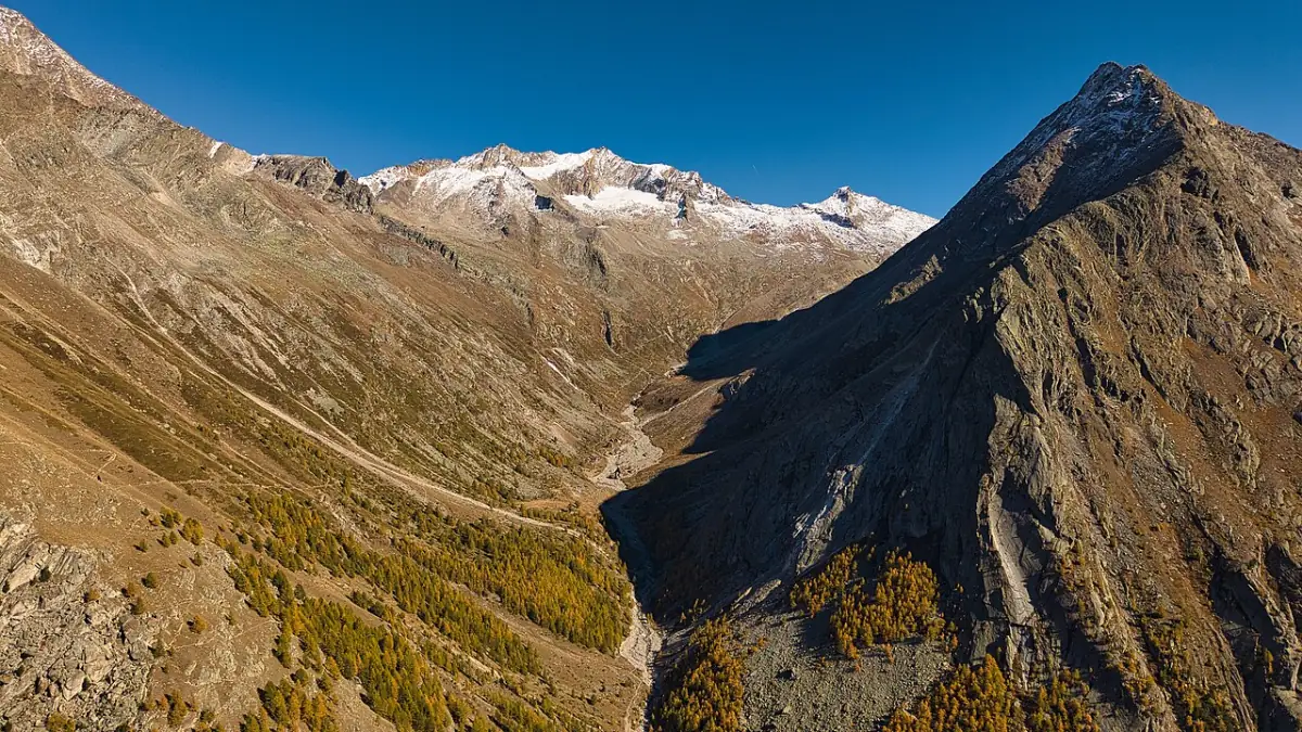
The Almagellertal above Saas-Almagell — context for high walks toward Almagelleralp.
Some hotel links are affiliate links. We may earn a commission at no extra cost to you. Read the disclosure.
Almagelleralp is a high alpine destination above Saas-Almagell — tourism copy commonly places the mountain hotel and restaurant context near ~2,194 m — used for day hiking, optional overnight stays at Berghotel Almagelleralp when open, and as a finish or waypoint on several named approaches. It is not a single numbered footpath and not interchangeable with a casual hamlet wander at Furggstalden.
Plan every outing with official distances, times, and difficulty grades for the start point you actually choose. Confirm lift and trail status on official opening information for Saas-Almagell and on current Saastal / Valais route pages before you leave the village. This page supports route-type decisions; it does not invent live hours, prices, or firsthand visit claims.
What Almagelleralp is (and is not)
Is: a high alp area with mountain-hotel and restaurant marketing in destination material; a common finish concept for the Saas-Almagell Adventure Trail; a waypoint on high connections discussed toward Kreuzboden / Saas-Grund; a planning destination that rewards map literacy.
Is not: a default stroller outing; a guaranteed open kitchen every calendar day; the same product as Mattmark reservoir walking; an automatic extension of a Furggstalden coffee stop; a substitute for reading T4 notes if you approach via bridges.
Compare walk types on the Hiking hub before you lock a day around Almagelleralp alone.
Route chooser (verify each row)
| Approach concept | Planning character | First checks |
|---|---|---|
| From Saas-Almagell village / valley paths | Ascent from ~1,672 m village base; grade and time depend on the signed line you follow | Official route page + map sheet; weather window |
| Via Furggstalden then Adventure Trail | Short but T4 / difficult with suspension bridges — optional, not default | Adventure Trail; lift status to start area |
| Höhenweg Kreuzboden–Almagelleralp | High traverse concept linking Saas-Grund lift context toward Almagelleralp | Season, grading, Kreuzboden lift status; Saas-Grund day trip |
| Continuations toward Zwischbergen Pass | Experienced parties only; separate commitment beyond a lunch stop | Pass conditions, daylight, escape options on current maps |
Do not paste brochure names into a GPS app without reading the grade. Marketing adjacency on a village page does not mean uniform difficulty.
Approaches from the village
Starting in Saas-Almagell means you own the elevation gain from the valley floor unless a lift segment shortens the approach. Official destination material repeatedly pairs Almagelleralp with walking from the Almagell side and with Furggstalden-area products, but turn-by-turn advice belongs on dated operator listings, not on paraphrased memory.
Practical planning habits for village starts:
- Choose the signed approach you can name on a SwissTopo or official digital route page.
- Publish a turnaround time that still allows descent in daylight and before forecast storms.
- Carry layers and water beyond café assumptions — mountain restaurants open seasonally.
- Treat afternoon thunderstorm risk as routine alpine summer planning, not an exception.
- If anyone in the party is height-averse, do not “just see how the Adventure Trail looks” as your village-to-alp shortcut without reading suitability notes first.
Village-based days pair well with a quieter overnight in Saas-Almagell — see Where to stay and Saas-Almagell vs Saas-Fee if you are still choosing a bed base.
Furggstalden as staging, not the destination
Furggstalden is the chairlift hamlet above the village. Official summer copy places soft activities, restaurants, and Mattmark outlooks there when lifts run. Almagelleralp sits further in commitment: higher, longer, or more exposed depending on the line you pick.
A sensible sequence for mixed groups is a Furggstalden reconnaissance day first — test weather, lift reliability, and altitude comfort — then an Almagelleralp day later in the stay. Collapsing hamlet wandering, Adventure Trail bridges, and a Berghotel meal into one afternoon is a common overcommitment. Heidbodmen panorama lunch context lives on Heidbodme and does not replace Almagelleralp route research.
Adventure Trail as one approach — T4, not a kids’ default
Partner and tourism listings describe the Saas-Almagell Adventure Trail (Erlebnisweg) from the Furggstalden mountain area toward Almagelleralp with figures commonly around ~2.8 km, ~1.5 h, ~386 m ascent, and difficulty T4 / difficult, including suspension bridges. Valais guidance notes adult accompaniment from roughly age six or seven only with sure-footedness and no fear of heights, and marks the route not suitable for dogs.
Read the dedicated suitability page before promising bridges to children or casual walkers: Adventure Trail. Many families should skip this approach entirely and still have a complete Almagelleralp-free holiday using Mattmark and Furggstalden — see Families. Finishing at Almagelleralp restaurant or hotel context after the bridges is optional logistics, not a guarantee that kitchens or rooms are open on your date.
Escape concepts mentioned in older partner text (for example descending from named features toward the village) must be signed and mapped on the day you walk. Do not invent shortcuts across unsecured slopes.
Höhenweg Kreuzboden–Almagelleralp
Destination and valley hiking conversation often includes a high trail (Höhenweg) concept between Kreuzboden and Almagelleralp. That line is a different planning problem from a village ascent or from the Furggstalden Adventure Trail:
- Start logistics usually involve Saas-Grund / Kreuzboden lift access rather than Almagell’s Furggstalden chairlift alone.
- Ticket brands can differ from Saastal Bergbahnen products you use above Almagell — read the operator you will ride.
- Season windows for high traverses may be shorter than valley walks; lingering snow can change difficulty without changing the marketing name.
- One-way logistics matter: if you ride up at Kreuzboden and walk toward Almagelleralp, confirm how you descend and return to beds in Saas-Almagell (foot, bus, or further lift segments).
Use Saas-Grund day trip for mid-valley lift framing, then verify the specific Höhenweg listing on official Saastal or Valais pages for your date. This site will not invent kilometre or hour figures until a dedicated mapped evidence pass is complete (see frontmatter todoVerify).
Continuations toward Zwischbergen Pass
Extensions toward Zwischbergen Pass appear in experienced-hiker conversation for the wider Almagellertal / border context. Treat them as separate commitments: longer days, higher consequence terrain, and stronger navigation requirements than a Berghotel lunch outing. Only parties with appropriate fitness, map skills, and weather windows should consider pass objectives — and only after reading current official or alpine-club style guidance for the exact line. This page does not grade or time those extensions without verified sources.
Berghotel Almagelleralp — season and expectations
Tourism material markets Berghotel Almagelleralp as a mountain hotel and restaurant above the village. Opening seasons, half-board rules, room availability, and kitchen hours must be verified with the hotel or current official listings for your travel week. Do not assume that a summer hiking brochure equals overnight capacity on your shoulder-season dates.
Planning implications:
- A day hike that “needs” a hot meal at the Berghotel fails if the kitchen is closed — carry backup food.
- An overnight at the Berghotel is a different trip shape from a village hotel base with day approaches.
- Phone and booking channels change; use contacts published on official tourism or hotel pages rather than third-party scrapes.
- Cuisine marketing language in destination copy is not a substitute for dietary confirmation if someone in your party has restrictions.
Village stays remain the default shortlist on Where to stay; treat Berghotel nights as a specialty product once season is confirmed.
How Almagelleralp relates to Mattmark
Mattmark sits at the valley head with dam and reservoir walking — a different approach, different transport (road or seasonal PostBus), and generally a different difficulty conversation from Almagelleralp high-alp routes. Valais notes on west-shore accessibility for the lakeside circuit apply to that specific Mattmark context, not to Almagelleralp approaches.
Do not schedule a full Mattmark circuit and a hard Almagelleralp approach on the same day unless your group is unusually strong and weather is stable. Most visitors should pick one high objective per day. Mattmark history context (including official acknowledgement of the 1965 Allalin glacier strike on the dam construction site) belongs on the Mattmark page — visit memorial areas respectfully when you go there instead.
Lift dependency and official status checks
Some approaches use chairlift access toward Furggstalden or toward Kreuzboden; others are foot-only from the village. In every case:
- Check open facilities for Saas-Almagell for Almagell-side lifts.
- Check the relevant operator page if your day starts at Kreuzboden / Saas-Grund.
- Confirm the trail listing separately from the lift listing — an open chairlift does not prove a high traverse is in season.
- Re-check on the morning of departure; alpine status can change with weather and maintenance.
This site does not publish live status.
SaastalCard and ticket framing for Almagelleralp days
Partner overnight guests may ride many valley cable cars under published SaastalCard summer/autumn terms, with common exclusions such as Metro Alpin and arrival/departure PostBus legs. A high day that mixes Almagell lifts with Grund lifts can still require reading two operator rules. Walking itself is often free; lifts to trailheads are not automatically irrelevant to budget. Details: SaastalCard.
Weather, altitude, and turnaround culture
Saas-Almagell village sits at 1,672 m in destination copy; Almagelleralp adds substantial further altitude. Parties arriving from sea-level airports should consider a gentler first day (village, Furggstalden hamlet, or partial Mattmark) before committing to long high approaches. Afternoon thunderstorms are a routine reason to start early and accept turnaround without “just another hour” negotiations on exposed ground.
MeteoSwiss forecasts for the Saas Valley are an appropriate official weather entry; microclimate at bridges, north-facing snow patches, or Kreuzboden can still differ. Carry navigation that works offline.
Families and mixed groups
Almagelleralp can work for strong, sure-footed families on non-bridge approaches when grades and weather fit — but it is the wrong place to surprise children with T4 exposure. Prefer Furggstalden soft products or Mattmark west-shore context when ages or confidence diverge. If teens insist on the Adventure Trail finish toward Almagelleralp, adults must read Adventure Trail and Families suitability notes aloud and plan sibling supervision before the group splits.
Dogs: do not assume valley-wide access because one brochure shows alpine scenery; Adventure Trail guidance explicitly excludes dogs on that approach.
Sample day shapes (assumptions stated)
These are planning sketches, not guaranteed itineraries. They assume operations and fitness match.
Village approach day: early start from Saas-Almagell on a signed ascent you verified; snack stops; optional Berghotel meal only if confirmed open; descent with storm margin; village evening.
Furggstalden + Adventure Trail day: lift to Furggstalden when operating; only continue on Adventure Trail if T4 suitability is accepted; Almagelleralp as optional finish; no Kreuzboden continuation the same day.
Höhenweg-oriented day: PostBus toward Saas-Grund; Kreuzboden lift if operating; high trail only if season and grade verified; reverse or onward logistics confirmed before ascent; see Saas-Grund day trip.
Recovery pairing: after any hard Almagelleralp day, schedule a light village or short Furggstalden hamlet day rather than immediately stacking Saas-Fee glacier products.
Common planning mistakes
- Treating Adventure Trail photos as proof Almagelleralp is an easy family highlight.
- Assuming Berghotel kitchen hours from last year’s social post.
- Starting a Höhenweg day without confirming Kreuzboden lift and return transport to Almagell beds.
- Stacking Mattmark full circuit and Almagelleralp hard approach on one calendar day.
- Trusting an undated GPS trace over official open-lifts and route pages.
- Continuing toward Zwischbergen Pass because “we still feel fine” at lunch without daylight maths.
How this page fits the hiking cluster
| Page | Owns |
|---|---|
| Hiking | Route-type chooser across Saas-Almagell |
| Adventure Trail | T4 bridge suitability and Furggstalden start detail |
| Furggstalden | Hamlet, soft activities, lift staging |
| Mattmark | Dam and reservoir days at the valley head |
| This page | Almagelleralp as destination: village approaches, Höhenweg framing, Berghotel season caution |
For a broader activity map without duplicating catalogues here, see Things to do. Season framing: Summer. Mobility: Getting around.
Packing notes specific to Almagelleralp objectives
Sturdy footwear with rock grip; poles if you normally use them on sustained ascent; rain shell; sun protection at altitude; extra food and water; gloves if cables or cold rock are possible on your chosen line; headtorch if there is any chance of a slow descent; charged phone plus offline map or paper SwissTopo. Winter or shoulder-season parties need traction and avalanche awareness appropriate to conditions — summer mesh trail shoes are not a snow plan. This list is planning aid, not a certification of any route.
Editorial limits
This guide paraphrases Saastal Tourism destination framing and related valley hiking references checked 2026-10-20. Official trail times, Berghotel season calendars, and any direct lift-to-alp claims remain on the todoVerify list until confirmed on primary sources. No firsthand visit claims, invented prices, or live open/closed guarantees appear here. When operator pages and this article disagree, follow the operator.
Related
Bookable ideas
Tours & activities in the region
Some hotel links are affiliate links. We may earn a commission at no extra cost to you. Read the disclosure.
- Hiking
Alpine hiking around Saas-Almagell
Valley walks, reservoir loops and higher options — timing depends on lift and bus operations.
- Confirm departure town and season on the partner page
- Recheck weather and lift status on the day
- Not a substitute for local mountain advice
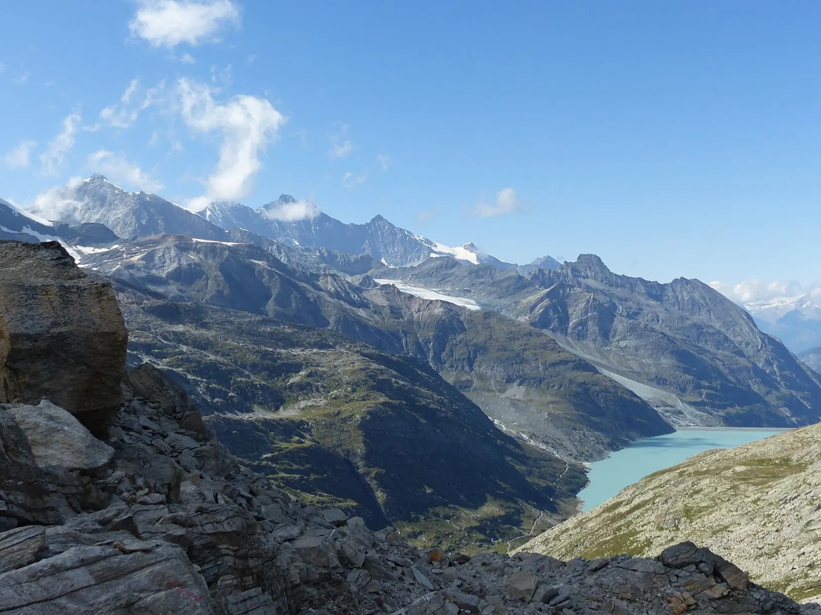 Viewpoints
Glacier and high-mountain viewpoints
High viewpoints often route via Saas-Fee — clarify meeting point before you pay.
- Meeting point is not always your hotel village
- Check fitness and family fit on the listing
- Read cancellation terms with the provider
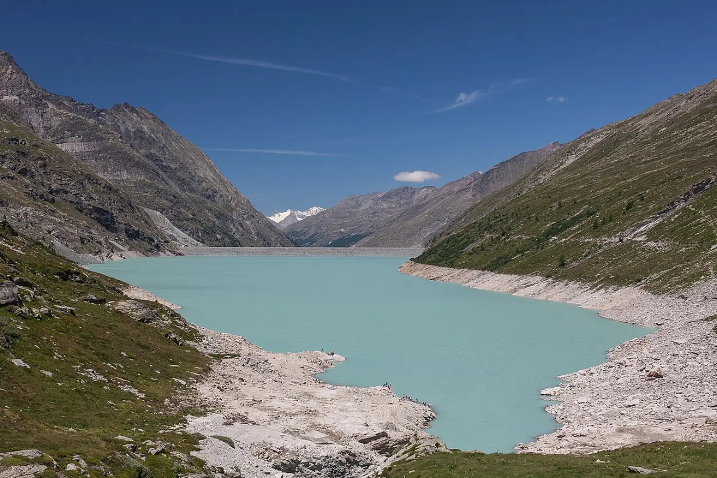 Day trip
Mattmark and valley day outings
Reservoir days and village hops — some transfer products start far from Almagell.
- Confirm seasonal bus and road access
- Verify departure town in the ticket text
- Independent PostBus options remain available
 Winter
 days in the Saas Valley
Ski and winter products often list Saas-Fee — confirm pass, meeting point and kit before payment.
- Not a live piste or avalanche bulletin
- Budget transfer time to the meeting point
- Use only attributed partner links from this site
See all regional tours & tickets →
Browse live listings
Loading live listings…
Planning questions
How long is the hike to Almagelleralp?
Publish only official trail times for your chosen start point. Until verified on saas-fee.ch or Valais route pages for that exact approach, do not rely on a single generic hour figure.
Is there a lift to Almagelleralp?
Lift status changes by season and maintenance. Confirm chairlift and facilities operation for your date on official Saastal opening pages rather than assuming a direct lift from the village hotel door.
Is the Adventure Trail the only way to reach Almagelleralp?
No. The Adventure Trail is one approach from the Furggstalden area and is rated T4 / difficult. Other approaches from the village or via the Höhenweg from Kreuzboden need separate map and grading checks.